Watching the 2027 eclipse from the Strait of Gibraltar and at sea
Published · Updated
On 2 August 2027 the path of totality crosses the Strait of Gibraltar mid-morning, so you can watch from Europe, from Africa or from a boat between them. This guide covers the shores on both sides and the water in the middle. We checked every point against our computed path first: all are inside it, as the table shows.
The Strait is about 14 km wide at its narrowest and lies in the territorial waters of Spain, Morocco and Gibraltar.1
Totality at each place
| Place | Inside the path? | Totality | Begins (local) | Sun | Horizon toward Sun |
|---|---|---|---|---|---|
| Tarifa (town centre) | Yes, 83 km from the edge | 4m 39s | 10:45:09 CEST | 38° up, az. 95° | 1.9° |
| Mirador del Estrecho (N-340) | Yes, 79 km from the edge | 4m 35s | 10:45:15 CEST | 38° up, az. 95° | -0.5° |
| Europa Point, Gibraltar | Yes, 74 km from the edge | 4m 31s | 10:45:33 CEST | 38° up, az. 96° | -0.2° |
| Monte Hacho, Ceuta | Yes, 98 km from the edge | 4m 48s | 10:45:24 CEST | 39° up, az. 95° | 2.0° |
| Ksar es-Seghir | Yes, 102 km from the edge | 4m 49s | 08:45:03 WET | 38° up, az. 95° | 6.0° |
| Café Hafa, Tangier | Yes, 107 km from the edge | 4m 50s | 08:44:44 WET | 38° up, az. 95° | 1.6° |
| Cap Spartel, Tangier | Yes, 107 km from the edge | 4m 49s | 08:44:37 WET | 38° up, az. 95° | 13.1° |
| At sea: Tarifa to Tangier Ville ferry, mid-crossing | Yes, 95 km from the edge | 4m 46s | 10:44:56 CEST | 38° up, az. 95° | 0.7° |
| At sea: Algeciras to Tanger Med ferry, mid-crossing | Yes, 84 km from the edge | 4m 40s | 10:45:18 CEST | 38° up, az. 95° | 0.0° |
| At sea: centre line, Atlantic side | Yes, 117 km from the edge | 4m 49s | 08:44:02 WET | 37° up, az. 94° | 0.0° |
| At sea: centre line, Mediterranean side | Yes, 117 km from the edge | 4m 54s | 08:45:38 WET | 39° up, az. 95° | 0.0° |
Computed for 2 August 2027 at each point, at sea level with a smooth lunar limb. “km from the edge” is the distance to the nearer edge of the path. Clocks differ across the Strait: Spain, Gibraltar and Ceuta are on CEST (UTC+2) in August, and Morocco is two hours behind on UTC+0 (shown as WET), so 08:45 WET = 10:45 CEST. Each time is local clock time at that place; the open-sea points use Moroccan time (WET). On a ferry, check which clock the crew is using. Horizon is the highest land in the Sun’s direction from a 90 m elevation model, ignoring buildings and trees.
The places
Tarifa (town centre)
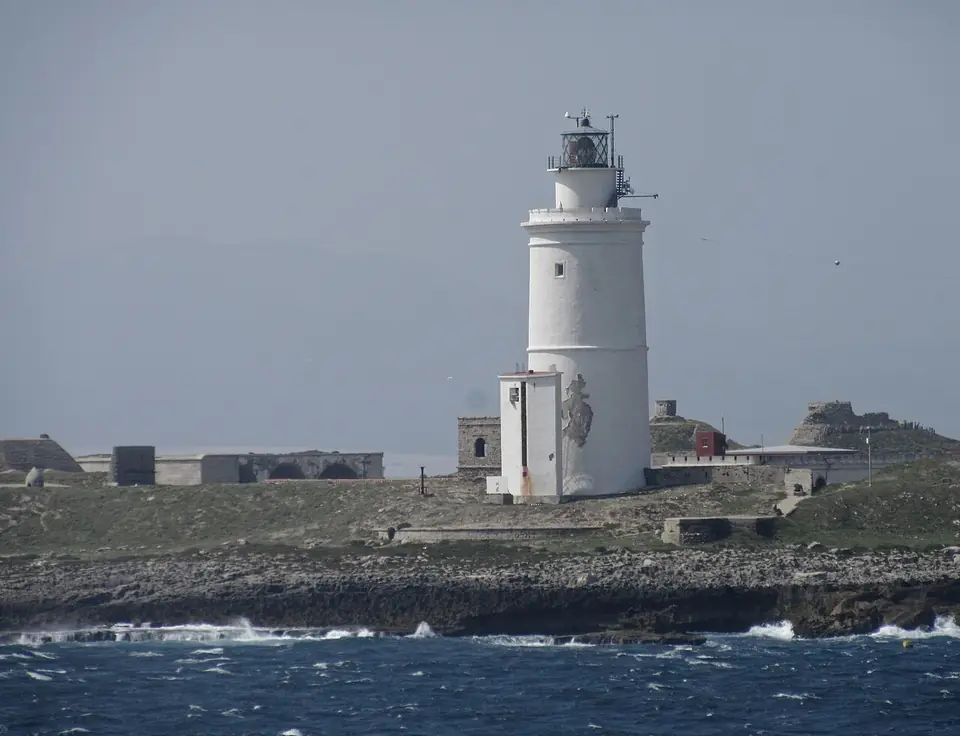

4m 39s totalityfrom 10:45:09 CESTSun 38° up35 km from the centre line, 83 km from the edgeAug. cloud cover 19%Aug. max 27°C
Tarifa, on the Spanish side of the Strait, is 35 km from the centre line. At totality the Sun is 38° up in the east, over the water.
Mirador del Estrecho (N-340)
4m 35s totalityfrom 10:45:15 CESTSun 38° up39 km from the centre line, 79 km from the edgeAug. cloud cover 19%Aug. max 27°C
A roadside viewpoint on the N-340 between Tarifa and Algeciras, about 300 m above the sea on our elevation model. The land falls away towards the Sun, so the sea horizon is below eye level.8
Europa Point, Gibraltar
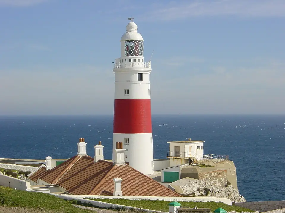

4m 31s totalityfrom 10:45:33 CESTSun 38° up44 km from the centre line, 74 km from the edgeAug. cloud cover 19%Aug. max 27°C
The southern tip of Gibraltar looks east and south over open water. It has the shortest totality of the places here, 4m 31s, because it is furthest from the centre line.
Monte Hacho, Ceuta
4m 48s totalityfrom 10:45:24 CESTSun 39° up20 km from the centre line, 98 km from the edgeAug. cloud cover 22%Aug. max 27°C
Ceuta is Spanish but on the African shore, so it is closer to the centre line than any of the European-side points here: 4m 48s on Monte Hacho.
Ksar es-Seghir
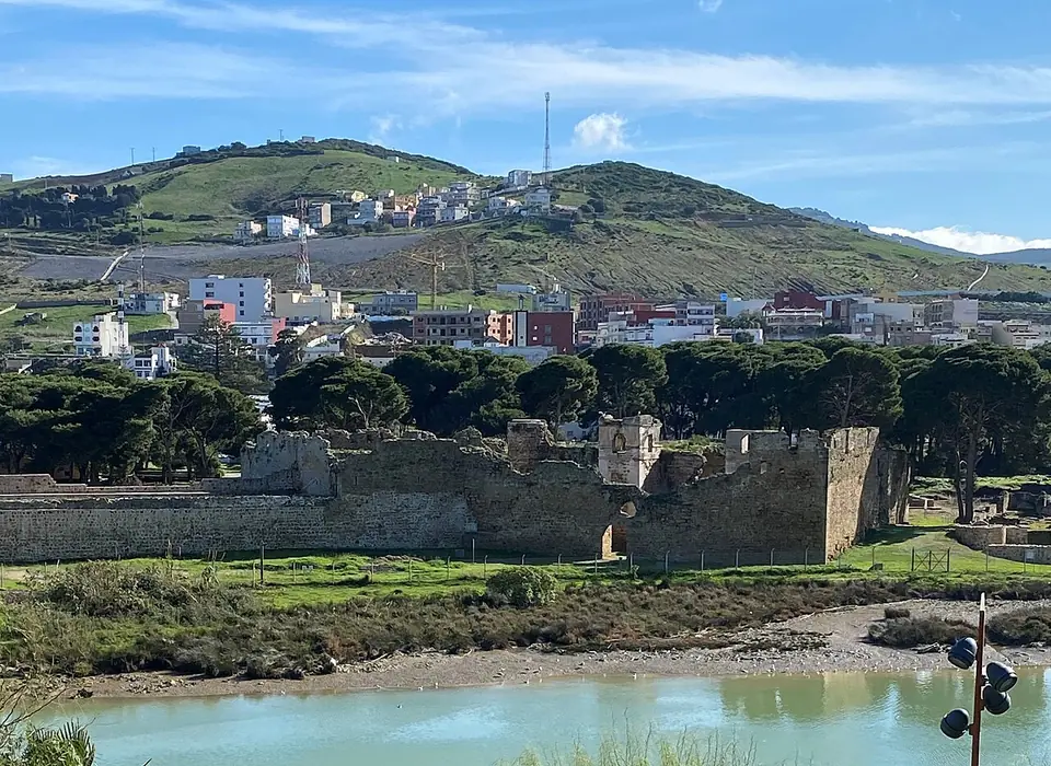

4m 49s totalityfrom 08:45:03 WETSun 38° up16 km from the centre line, 102 km from the edgeAug. cloud cover 22%Aug. max 27°C
A small Moroccan coastal town between Tangier and Ceuta, 16 km from the centre line. Hills to the east rise to about 6° in the Sun's direction, well below the Sun.8
Café Hafa, Tangier
4m 50s totalityfrom 08:44:44 WETSun 38° up11 km from the centre line, 107 km from the edgeAug. cloud cover 22%Aug. max 27°C
Tangier is 11 km from the centre line, with 4m 50s at Café Hafa. The far coast across the water is the horizon, under 2° high in the Sun's direction.8
Cap Spartel, Tangier
4m 49s totalityfrom 08:44:37 WETSun 38° up11 km from the centre line, 107 km from the edgeAug. cloud cover 22%Aug. max 27°C
Our elevation model has a hill 0.7 km east of the lighthouse spot that rises 13° in the Sun's direction. The Sun at totality is 38° up, so it still clears it, but Tangier's town side has a lower view east.8
At sea: Tarifa to Tangier Ville ferry, mid-crossing
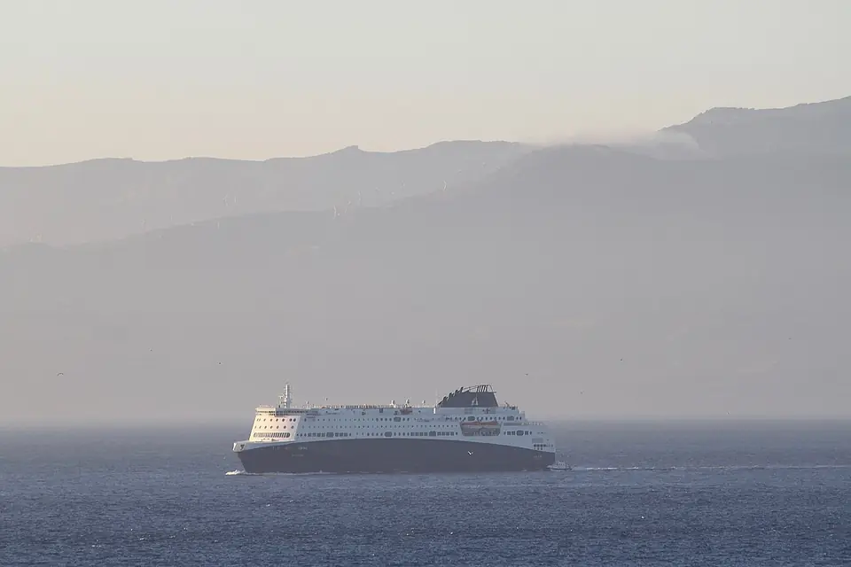

4m 46s totalityfrom 10:44:56 CESTSun 38° up22 km from the centre line, 95 km from the edgeAug. cloud cover 22%Aug. max 27°C
Baleària runs the Tarifa to Tangier Ville fast ferry, a crossing of about an hour. FRS stopped running this route in May 2025.2,3
At sea: Algeciras to Tanger Med ferry, mid-crossing
4m 40s totalityfrom 10:45:18 CESTSun 38° up34 km from the centre line, 84 km from the edgeAug. cloud cover 22%Aug. max 27°C
Algeciras to Tanger Med takes about 1 hour 30 minutes with FRS/DFDS, which also sails Algeciras to Ceuta.3
At sea: centre line, Atlantic side
4m 49s totalityfrom 08:44:02 WETSun 37° up0 km from the centre line, 117 km from the edgeAug. cloud cover 30%Aug. max 26°C
On the centre line west of the Strait, off the Moroccan coast.
At sea: centre line, Mediterranean side
4m 54s totalityfrom 08:45:38 WETSun 39° up1 km from the centre line, 117 km from the edgeAug. cloud cover 42%Aug. max 28°C
On the centre line east of the Strait, off the Moroccan coast, with the longest totality in this guide: 4m 54s.
Is each place inside the path?
Yes. Every point above is inside the path, which is about 240 km wide here. Europa Point is the closest to an edge, 74 km inside the northern limit. The centre line runs along the Moroccan side of the Strait, so the African shore gets longer totality than the European one.
Sun height and horizon
The Sun is about 37° to 39° up in the east (azimuth about 95°) during totality, much lower than in Egypt. That makes the eclipse easy to frame over the sea or the far coast. We checked the land in the Sun's direction with a 90 m elevation model at every point: the only real obstruction is the hill above Cap Spartel at 13°; everywhere else the horizon is below 6°. The model ignores buildings and trees, so check your exact spot.8
Watching from a boat
The longest totality in the area is on the water. On the centre line totality is 4m 49s west of the Strait and 4m 54s east of it, against 4m 39s in Tarifa. A moving boat changes this very little: the shadow crosses the Strait at about 4,600 km/h, so even a boat sailing at 40 km/h along the shadow's track would change totality by only about 3 seconds.
The catch is cloud. In the NASA POWER grid cells we used, the open Mediterranean east of the Strait averaged much more August cloud than the Strait itself, and the Atlantic cell also more; the cells are about 50 km across, so treat this as a rough guide.7
A regular ferry crossing around totality, about 10:45 Spanish time, would put you inside the path for the whole crossing. We have not found any operator announcing an eclipse sailing, and you cannot count on deck access or on the timetable on the day. If you charter a boat, use a licensed operator, and remember that the Strait is in Spanish, Moroccan and Gibraltar waters, so the boat must have permission to be where it goes.1
Getting across and the summer crossing season
2 August is in the middle of Operation Crossing the Strait (Operación Paso del Estrecho), the summer movement of people travelling between Europe and North Africa. In 2026 it ran from 15 June to 15 September and carried 3,367,004 passengers, after 3,488,885 in 2025. The port authority named 1 and 2 August 2026 as the most critical days of the southbound phase at Algeciras and Tarifa, with up to 77 sailings a day, and cars could enter Tarifa port no more than 2 hours before departure. On Saturday 1 August 2026, 39,006 passengers and 10,056 vehicles sailed from Algeciras and Tarifa, Tarifa set a daily record of 1,929 cars, and the port moved to emergency level 1 because its waiting areas were full.4,9,5,10
2 August 2027 is a Monday. The 2027 dates and peak days are not yet published.
In practice: do not plan to cross the Strait on eclipse morning, with or without a car. Cross days before and stay on the side you plan to watch from.
Weather and heat
The Strait is much cooler than Egypt: the mean August daily maximum is about 27°C on the shores. The bigger risk is cloud and haze. Over 2001 to 2025 about 60% to 64% of August days on the shores had less than 20% cloud. The easterly levante wind, which funnels through the Strait, often brings cloud and rain.7,6
Crowds
Eclipse visitors will share the ports, roads and ferries with the peak of the summer crossing. Book rooms, ferries and parking early, and pick a viewing spot you can walk to.
Country pages: Spain, Morocco, Gibraltar. See also where to watch the 2027 eclipse, the totality map for your exact spot, and eclipse glasses for the partial phases.
Sources
- Wikipedia: Strait of Gibraltar
- Baleària: ferry from Tarifa to Tangier Ville
- FRS: Tarifa to Tangier Ville route closure and Algeciras to Tanger Med
- Protección Civil (Spain): Operación Paso del Estrecho
- La Voz Digital (3 July 2026): Algeciras and Tarifa activate the OPE plan with up to 77 sailings a day
- Wikipedia: Levant (wind)
- NASA POWER daily data, August 2001 to 2025 (cloud amount, daily maximum temperature)
- Open-Meteo Elevation API (Copernicus 90 m elevation model)
- ANAVE: OPE 2026 passenger and vehicle totals
- El Estrecho Digital (2 August 2026): OPE peaks at Algeciras and Tarifa
Totality, local times, Sun position and distances are computed from NASA Besselian elements (see our method). Cloud and temperature: NASA POWER daily data for August 2001 to 2025, for grid cells about 50 km across. Terrain: Copernicus 90 m elevation model via Open-Meteo, with Earth curvature and refraction.
Frequently asked questions
Is it better to watch the 2027 eclipse from Spain or Morocco at the Strait?
The centre line runs along the Moroccan side of the Strait, so the African shore gets longer totality than the European one. Both shores are inside the path, and the Sun is low in the east, which makes it easy to frame over the sea.
Can I watch the eclipse from a ferry across the Strait of Gibraltar?
Yes, a crossing around totality would keep you inside the path the whole way, and a moving boat changes totality very little. 2 August is also the peak of the summer crossing season, so book early and expect busy ports.
What is the weather risk at the Strait of Gibraltar in August?
Cloud and haze matter more than heat. The easterly levante wind, which funnels through the Strait, often brings cloud and rain, so watch the forecast in the days before and keep a backup spot in mind.